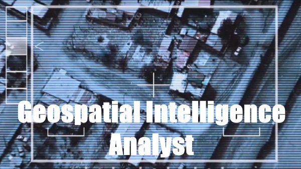
Geospatial Intelligence is an Air Force specialty that will appeal to anyone that wants an important military enlisted role and also wants to work in a highly classified environment.
Those that pass the Air Force Geospatial Intelligence training course will work in a high visibility position (Generals and Colonels will know you on a first-name basis) and be privy to sensitive intelligence information that few people in the world will ever know.
Jump To A Section
Requirements And Qualifications
Training And Career Path
Salary
What’s Life Like As A 1N131?
Civilian Career Opportunities
As an Air Force Geospatial Intelligence specialist you will be tasked with doing such things as:
- Providing analysis of such intelligence gathering means as satellite imagery, infrared imagery, synthetic aperture radar, and aerial reconnaissance photos.
- Supporting current intelligence briefings.
- Providing all branches of the military with critical information about enemy forces that support combat operations.
- Using advanced mensuration techniques to determine the location and dimensions of objects
- Conducting battle damage assessment
This Air Force specialty will appeal to just about anyone and the security clearance alone will open up many avenues into civilian employment.
Check out the Air Force recruiting video below for Geospatial Intelligence analysts:
Requirements and Qualifications
Below are the conditions and requirements an individual has to meet in order to serve in the US Air Force as a Geospatial Intelligence specialist:
Educational Requirements
- High School Diploma
- GED
- GED with 15 college credits
ASVAB Requirements
- Minimum ASVAB Score of 66 in the General category
Additional Requirements
- Must be between the ages of 17 and 39
- Have normal color vision
- Meet required depth perception standards
- Completion of 8.5 weeks of Air Force Basic Military Training
- Possess the ability to successfully learn advanced imagery interpretation principles, techniques and procedures
- Must be able to attain a Top Secret security clearance after undergoing a Single Scope Background Investigation (SSBI)
Related Article – Cyberspace Operations Officer: Pay, Training, And More
Air Force Geospatial Intelligence Training and Career Path
This is an enlisted Air Force job specialty that requires several training steps by an individual in order to be allowed to serve in this capacity. They are as follows:
Air Force Technical Training

Qualified candidates that have undergone and successfully completed Air Force Basic Training will then have to complete the required technical training for this career field.
That training takes place at Goodfellow AFB in San Angelo, Texas, home of the 17th Training Wing (17TRW).
The course is conducted in under a four-month period.
It is not unusual to attend the course with those from other branches of the military, such as future Army, Navy, Coast Guard, and Marine intelligence specialists.
Those that pass the course will also earn college credits in the Intelligence Studies and Technology areas.
Related Article – Air Force Signals Intelligence Analyst (1N2X1): Career Details
How Much Do Air Force Geospatial Intelligence Personnel Get Paid?
Those who enter into a career in the Air Force as a Geospatial Intelligence specialist will receive the standard military enlisted personnel pay rate.
That is unless someone has other prior civilian or military experience or college credits.
Typically, most Geospatial Intelligence specialists will start out under what is known as an E-1 to E-3 pay grade (your recruiter will tell you which pay grade you qualify for) with two years or less military service.
Set enlisted pay rates for those with two years or less service are as follows:
Airman Basic (E-1): $1,680.83/Month
Airman (E-2): $1,884.09/Month
Airman First Class: $1,982.27/Month
One has to keep in mind that this is just base pay. If an enlisted person is allowed to be housed off base they will also receive housing, food, and other forms of living assistance.
For example, you’ll likely be entitled to Basic Housing Allowance (BAH) pay as well.
Check out our handy BAH calculator below to see how much you could potentially receive in BAH payments:
Enter Your Duty Zip Code (Not Residence Zip Code)
Healthcare is also totally paid for while you serve your country.
Rank advancement is done by combining time in service with earned promotions.
There are also a limited number of special promotions available in the Air Force.
Those who complete a bachelor’s degree while serving as an enlisted member are also eligible to apply to go to officers’ training school (OTS).
Related Article: Air Force Ranks And Pay
What’s Life Like as a Geospatial Intelligence Specialist?
This is definitely not your typical 9 to 5 job. That’s because you will be privy to highly classified information that requires you to work in a very secure environment.
That means each day you will have to pass through security checkpoints with proper credentials to get to your work area.

As mentioned earlier, because of the importance of your position in the military, you will also have more contact with high ranking military and civilian personnel than most enlisted members of the Air Force experience.
The best part is working in a team environment to accomplish the goals set forth for your unit by your superiors.
Like all military jobs, you will have to be prepared to work during any time period.
This takes on even more significance when working in a critical intelligence type specialty like Geospatial Intelligence.
These types of positions require personnel to be present to do the job 24-hours a day, 365-days of the year.
So, alternating shift work is definitely a possibility.
In peacetime, you will be afforded all of the luxuries that any Air Force enlisted member can take advantage of and more.
They include:
- The opportunity to participate in base-sponsored sports and recreation
- The ability to take advantage of reduced prices at on-base shopping facilities
- Weekly days off and 30-days leave with pay each year
- The ability to travel on temporary duty assignments (TDY)
- Enlisted personnel are assisted to attend college courses in their off time in pursuit of a college degree
Likely duty stations for those working in Geospatial Intelligence can be found both stateside and abroad.
They may also include both temporary and fixed intelligence-gathering locations.
Of course, if enlisted personnel are stationed overseas, they are usually encouraged to take in the sights and go exploring in their host country.
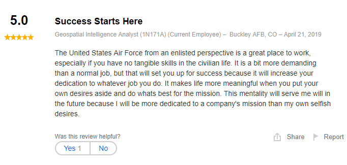
Here is what others had to say on Indeed.com, that experienced for themselves what working in this type of military capacity was like:


Both of these former enlisted personnel pointed out how proud they were to serve their country in the US Air Force.
They also indicated that working conditions were not always ideal; that’s all part of being in the military at times.
These former Air Force enlisted members also indicated they were able to see some of the world while they served their country and used their tie in service as a springboard to civilian employment.
Civilian Career Opportunities
Once you have served in the Air Force as a Geospatial Intelligence Specialist it will open up many avenues for you towards civilian and government employment.
Here are a few examples of those job opportunities:
Geospatial Intelligence Related Government Jobs
- Defense Intelligence Agency Washington, D.C.

This is the government equivalent of working in the Air Force as a Geospatial Intelligence Specialist.
They analyze many of the same intelligence gathering means that those working as a Geospatial Intelligence Specialist in the Air Force do.
The big advantage of going from a military to a government job is that a prior enlisted member will start out at a higher pay rate and their military service will count as time towards their retirement.
- National Imagery and Mapping Agency (NIMA) Springfield, Virginia

This is another government agency that’s work closely corresponds to the work that those acting as Geospatial Intelligence Specialists in the Air Force were responsible for.
They make maps of locations all over the world for civilian and military applications.
Once again, this is a government job where time served in the military counts for pay grade incentives and as time towards retirement.
These jobs go by what is known as a General Schedule (GS) pay scale.
Ex-Air Force Geospatial Intelligence personnel can expect a GS pay scale that will pay them somewhere between $35,000 – $70,000 a year with benefits.
Civilian and Government Job Opportunities
A powerful commodity that many potential Air Force recruits tend to overlook is a Top Secret security clearance.
Given the sensitive nature of their work, Geospatial Intelligence Analysts are issued a Top Secret Security clearance.
This is a valuable commodity when looking for other civilian and government employment.
Here are some companies that are known to hire former Air Force personnel that possess a Top Secret Security Clearance:
- Boeing Aerospace Company Chicago, IL
- General Dynamics Corporation Falls Church, VA
- Raytheon Company Waltham, MA
- Rand McNally Chicago, IL
All of these are Fortune 500 companies that work in tandem with the US Government on a routine basis.
With prior military experience, these jobs typically start out between $45,000 – $80,000 a year.
Have A Question About Air Force Geospatial Intelligence? Leave It In The Comments Below!
References / Resources
Official Air Force Geospatial Intelligence website
- 5 Worst Jobs in the Air Force - June 20, 2024
- 4 Steps For Visiting An Air Force Recruiter Near You - June 19, 2024
- Air Force Safety Specialist (1S0X1) - June 19, 2024
General FAQ
What does an Air Force Geospatial Intelligence analyst do?
In USAF, Geospatial Intelligence analysts gather data from satellite, infrared and radar imagery as well as aerial reconnaissance. They analyze the data and provide intelligence briefings on findings.
How much does a USAF Geospatial Intelligence Analyst make?
Like all military personnel, Air Force Geospatial Intelligence analysts are paid according to rank and time in service. Currently, airmen with rank of E-1 and less than two years of service make a base pay of $1,733 per month.
What is required to get into Air Force Geospatial Intelligence?
To become an Air Force Geospatial Intelligence Analyst, you’ll need a minimum score of 66 in the General category, normal depth perception and color vision, and a Top Secret security clearance.
How long is tech school to train in Air Force Geospatial Intelligence?
Held at Goodfellow AFB, Texas, tech school for Air Force Geospatial Intelligence analysts takes about four months.
What can an Air Force Geospatial Intelligence analyst do in the civilian world?
With a Top Secret clearance, many Air Force Geospatial Intelligence analysts transfer to civilian careers in the government contracting industry and work with aerospace companies.
Originally posted on June 16, 2019 @ 5:25 pm
Affiliate Disclosure: This post may contain affiliate links. If you click and purchase, I may receive a small commission at no extra cost to you. I only recommend products I have personally vetted. Learn more.
